MP: `Akhand Bharat' map sets off row

Indore: A map of `Akhand Bharat' (undivided India) installed by the Indore civic body on a busy road has created controversy, with the opposition Congress in Madhya Pradesh asking whether it was in line with India's foreign policy.
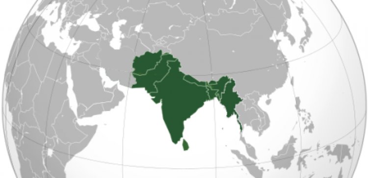
The mural-like installation at Footi Kothi Crossing was put up by the civic traffic department two years ago, an official said. It covers the entire subcontinent including Pakistan and Bangladesh, and shows topographical features but not the existing national boundaries.
Madhya Pradesh Congress spokesperson Aminul Khan Suri in a press statement on Friday said the Union government should clarify if the map was in line with India's foreign policy and an "indication of things to come".
"Wouldn't it affect relations with neighbouring countries?" he asked.
He also sought action against Indore Municipal Corporation (IMC) officials who allowed the map to be installed in a public place.
IMC Regional Officer Yogendra Gangrade said the mural was installed by the traffic department two years ago, but for some reason it was not unveiled. Someone removed the cover on it a couple of months ago, he said, adding that he did not have more details.
Indore MP and BJP leader Shankar Lalwani said the map reflected history.
When India was Akhand (undivided), the neighbouring countries were part of it. Our boundaries had spread far and wide. Keeping these historical facts in mind someone has installed it," the MP said.