Delhi records eighth cold wave day in Jan; most in 1 month in past 12 yrs

New Delhi: Delhi logged its eighth cold wave day in January on Wednesday, the most in the month in at least 12 years, according to data available on the India Meteorological Department website.
The Sadarjung observatory, Delhi's primary weather station, recorded a minimum temperature of 2.6 degrees Celsius. It was 2.4 degrees Celsius on Tuesday and 1.4 degrees on Monday.
Delhi saw seven cold wave days in January 2020, while it did not record any such day last year.
The city recorded an intense coldwave spell from January 5 to 9, the second longest in the month in a decade, according to IMD data.
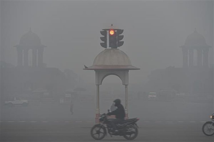
It has also logged over 50 hours of dense fog this month so far, the most since 2019.
The Met office said coldwave conditions would abate from Thursday-Friday under the influence of two western disturbances that are likely to affect the region in quick succession.
When a western disturbance -- a weather system characterised by warm moist winds from the Middle East -- approaches a region, the wind direction changes.
The city may also see light rain or drizzle towards Thursday night.
Light to moderate rain and a hailstorm with winds gusting up to 50 kilometres per hour are predicted to lash northwest India, including Delhi, on January 23-24 under the influence of another western disturbance.
Delhi has not recorded any rainfall this winter season so far. The Met department attributed it to the lack of strong western disturbances in November and December.
Last year, the city had recorded 82.2 mm rainfall in January, the highest in the month since 1901.